



by Steve French
This past April, I went along with a group of eight other Civil War enthusiasts on a hike to Indian Lookout, site of an important Union signal station during the Gettysburg Campaign. The spot is located atop a rock break high above Mt. Saint Mary’s University in Emmittsburg, Md.
Throughout the conflict, both sides used signal stations to transmit intelligence by flags whose positions represented numbers. Using this system, a signal officer could send coded message over long distances. At night, torches were sometimes also put into play.
From high elevations, officers used high-power telescopes to track enemy movements. For example, in this locale the Union signal station atop Maryland Heights, above Harpers Ferry, had a birds-eye view of the lower Shenandoah Valley and could easily communicate with other stations in Martinsburg, Charles Town and even Winchester, Va.
One on the western slope of Fairview Mountain, near Indian Spring, Md. also kept watch.
Us hikers met at the parking lot of The Grotto, a well-known Roman Catholic shrine on the university grounds. From there, it would be 1.25 miles and an increase of some 600 feet in elevation to the top.
Our guides for the day were Dean Schultz and Britt Isenberg. And for us, we could not get any better. Plus, the weather was great.
In my opinion, 88-year-old Schultz is the eminent authority on anything about Gettysburg’s history, especially the battle.
Born and raised just south of town, his house is situated on property that saw fighting along the famed “Lost Avenue.” A civil engineer by trade, Dean is also a highly respected and renowned guide. In fact, he is only one of six individuals ever given an honorary guide badge by the Association of Licensed Battlefield Guides.
Isenberg is the Gettysburg Foundation’s Vice-President of Community and Civic Engagement. Along with being an avid-hiker and hardy outdoorsman, his knowledge of the local geology also added to the enjoyment of the hike.
The group also included George Tyler Moore Center director Dr. Jennifer Murray, former National Park Service Harpers Ferry Park historian Dennis Frye, and author Tim Snyder, whose recently published Stonewall Jackson’s Winter Operations is fast becoming the standard work on the Bath-Romney Campaign.
From its beginning to the halfway point, the trail is very steep and extremely rocky. In fact, you have to keep a sharp lookout so as to not stumble over a loose rock or the occasional fallen branch. Farther on, the way became much easier going, although in places still somewhat steep.
We were in no hurry, so it probably took us 45-60 minutes to reach the summit. Along the way, Dean Schultz regaled the group with great stories, and Britt Isenberg chimed in with a few historical tidbits and occasionally identified rocks that hikers had picked up.
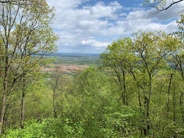
Gazing north from the lookout, most of the group could see Culp’s Hill, Little Roundtop and the huge Pa. Monument with the naked eye, some 11-12 miles away. Once binoculars were put to use, though, other features of the battlefield came distinctly into view.
photos by Tim Snyder
After descending the heights, we searched the bordering Mount Saint Mary’s Cemetery to find the final resting place of Daniel M. Beltzhoover, a math professor who resigned his position at the beginning of the war. When he left for the south, 30 students went with him. A West Point grad, he soon commanded Watson’s Louisiana Battery.
Losing these and other southern boys put great financial hardship on the school, then a college. In fact, one future graduating class consisted of only two scholars.
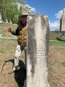
Finally, we found the grave of Louisiana native Maurice Bryne, a student who quit school sometime in 1864. His headstone recorded that he was killed at Clear Spring on July 26, 1864.
Our last stop was at the Mt. Saint Mary’s athletic field. Wrapping up, Dean related that in 1913 a baseball scout watched teenager Babe Ruth play an exhibition game there and was so impressed that he recommended him to the then minor league Baltimore Orioles. The rest is baseball history.